Rinjani looks deceptively close from Lombok's beaches — a green pyramid rising straight out of rice paddies and coastline. Up close it's 3,726 metres of loose volcanic sand, exposed ridgelines, and a turquoise crater lake that most trekkers only see after a full day of climbing. This guide covers the practical decisions: which route to take, how many days to book, what a legitimate operator charges, and when the park is actually open.
Most people book a guided three-day, two-night trek that summits and drops into the caldera for a swim and a soak in hot springs. Get the fitness prep and season timing right and the crater-rim sunrise delivers; get them wrong, and a summit morning turns into a slog you won't finish.
Mount Rinjani at a Glance
Mount Rinjani rises 3,726 metres (12,224 ft) above Lombok in Indonesia's West Nusa Tenggara province, making it the country's second-highest volcano after Sumatra's Mount Kerinci. It sits on the Sunda Arc, the stretch of the Pacific Ring of Fire where the Australian plate slides beneath Lombok and its neighboring islands. The whole massif is protected inside Gunung Rinjani National Park, a 41,330-hectare reserve established in 1997 that straddles the Wallacea zone, where Asian and Australasian wildlife overlap. Read more in our full Mount Rinjani overview.
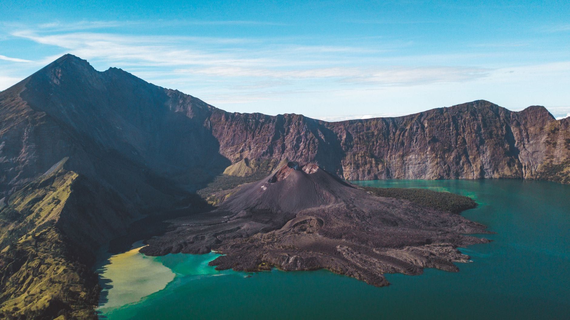
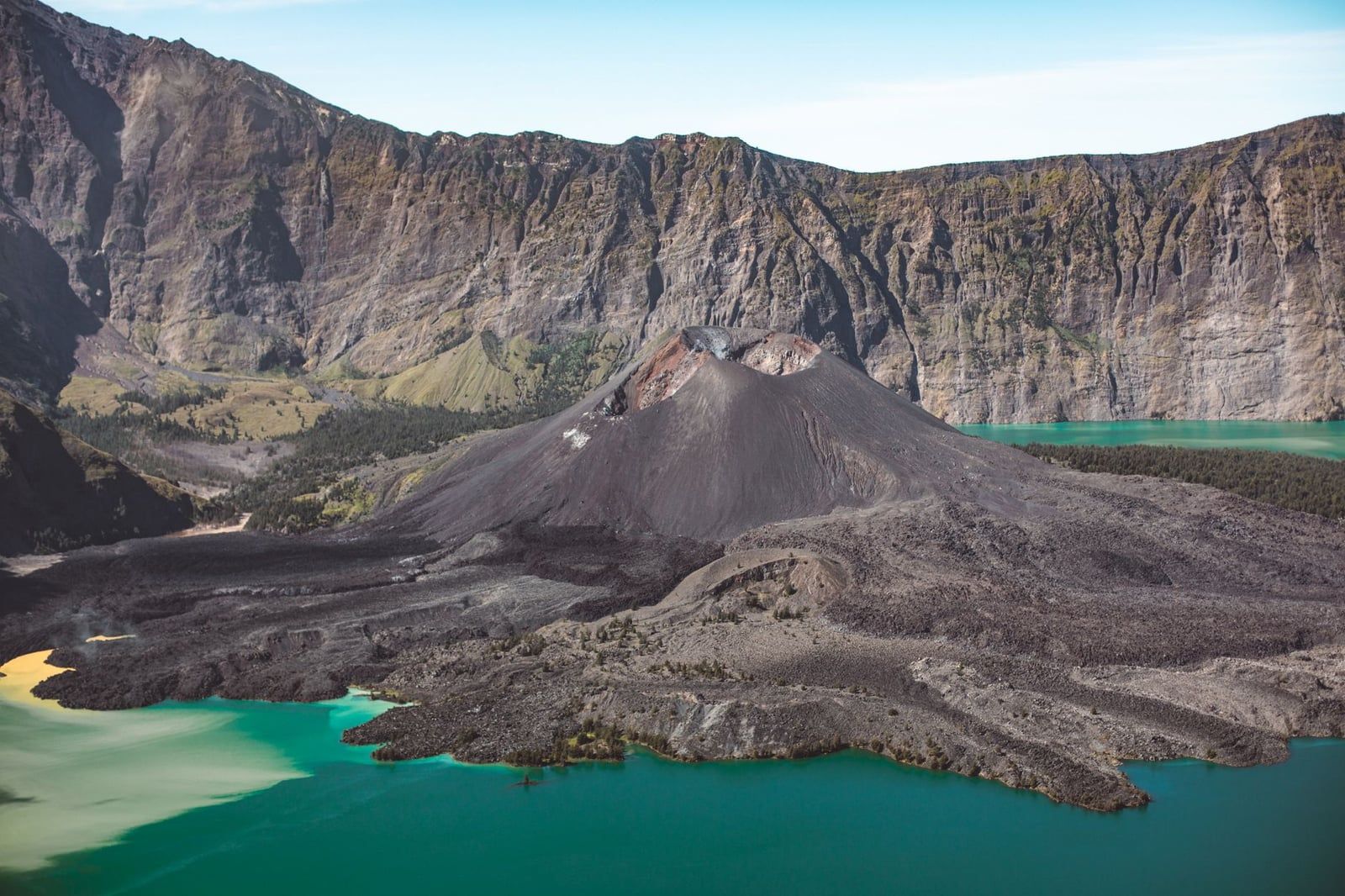
The centerpiece is Segara Anak, a turquoise crater lake filling a caldera roughly 6 by 8.5 km wide, formed when the catastrophic 1257 eruption of Rinjani's former twin peak, Samalas, collapsed the mountaintop. The active cone Mount Barujari still smokes inside that caldera — it last erupted in September 2016 — and hot springs bubble up along the lake's edge. UNESCO added the Rinjani Caldera to its Global Geopark network in April 2018.
| Detail | Mount Rinjani |
|---|---|
| Elevation | 3,726 m (12,224 ft) |
| Location | Lombok, West Nusa Tenggara, Indonesia |
| Difficulty | Challenging, non-technical |
| Typical duration | 2-4 days / 1-3 nights |
| Cost range | US$150-450 per person, guided |
| Best season | May-October (park closed Jan-Mar) |
How Hard Is Hiking Mount Rinjani
Rinjani doesn't require ropes or scrambling, but it punishes anyone who skipped training. From Sembalun, day one alone gains around 1,500 metres over roughly 8 km, with most of that climb packed into the final 4 km before camp. That's steep enough to leave unconditioned legs shaking at the crater rim, long before the summit push even starts.
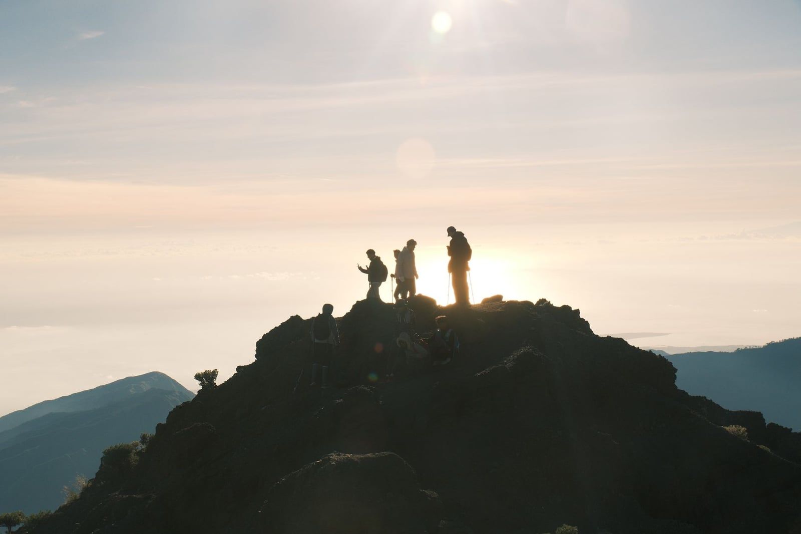
The summit day is worse. The last kilometre to the top crosses loose volcanic sand and scree that swallows each step, and it typically takes about three hours to cover — trekkers leave camp around 2am by headlamp specifically to bank that time. Add wind and temperatures of 3-5°C at 3,726 metres, and it's no surprise that an estimated 10-20% of climbers turn back short of the top, usually from exhaustion, cold, or altitude effects rather than any technical obstacle.
Four to six weeks of cardio and stair-climbing beforehand makes a real difference, and pack-loaded training hikes help condition your legs for the steep descents that follow the summit.
Trekking Routes Compared: Sembalun, Senaru & Torean
Rinjani has three main trekking gates, and the direction you combine them in matters more than most first-time planners realize.
Sembalun Route
Sembalun starts in open savanna, rolling grass hills that turn gold in dry season and are dotted with wild edelweiss. The gradient climbs gradually before steepening toward the crater rim, which is why it's the preferred ascent route for summit attempts — trekkers reach Pelawangan Sembalun camp with legs fresher than they would via the alternatives.
Senaru Route
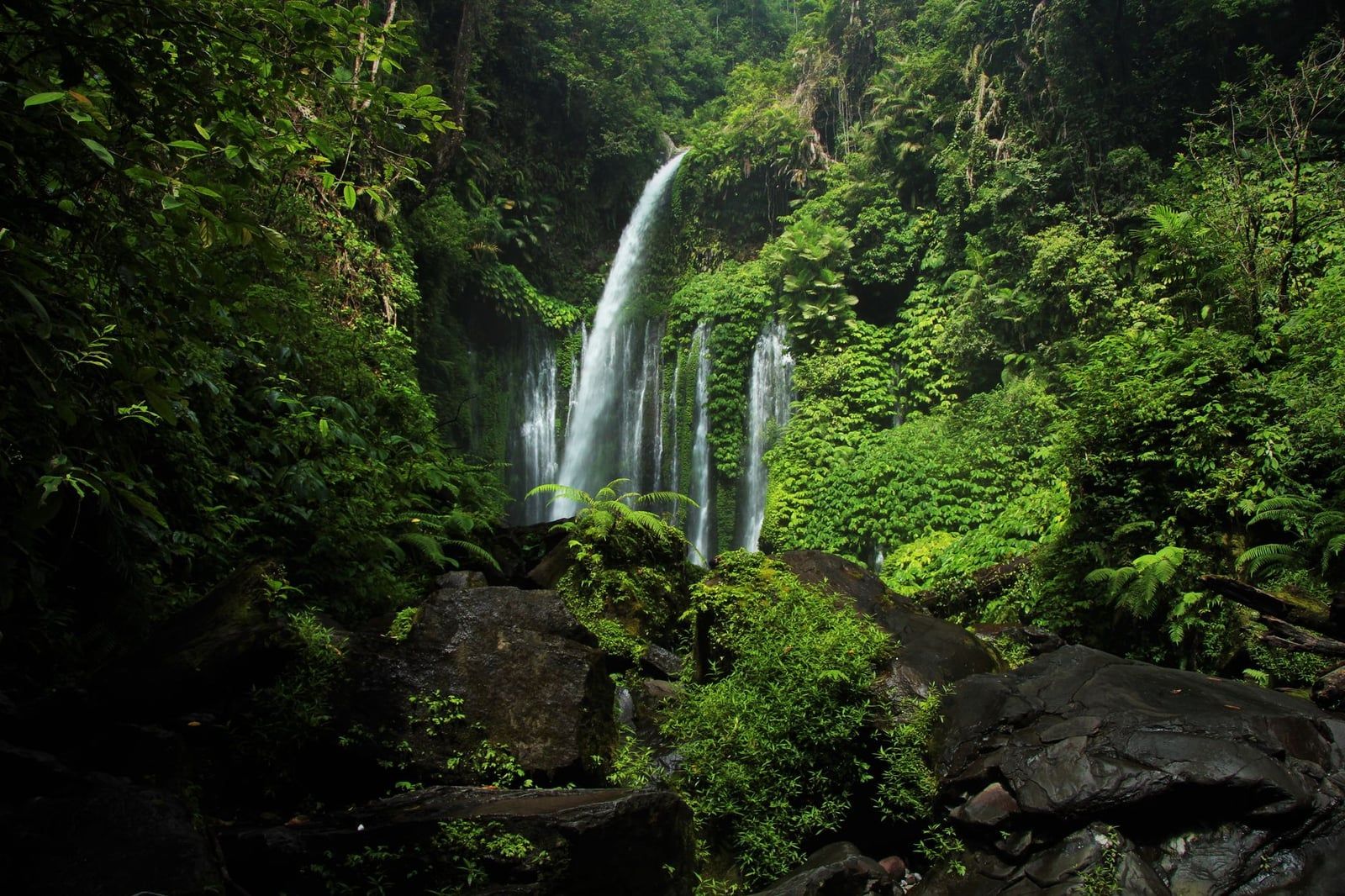
Senaru climbs through dense montane rainforest, passing waterfalls like Tiu Kelep near the trailhead and giving trekkers a shot at spotting long-tailed macaques along the way. It's steeper and more technical underfoot early on, which is why most operators use it as a descent route, or as a shorter, summit-free crater-rim trip for those short on time or fitness.
Torean Route
Torean threads through river valleys and past several waterfalls on the caldera's northern side, and it's the most scenic way out after a summit and lake visit. It's also the toughest descent option — narrower and less trafficked, better suited to trekkers who already have a summit day behind them. Aik Berik, further south, skips the summit entirely and suits travelers who want the crater lake and hot springs without the 2am scree slog.
Most Rinjani trekking tours build the classic loop as Sembalun up, Senaru down, covering the summit, the crater lake, and the hot springs in one continuous route.
How Many Days Do You Need: 2D1N vs 3D2N vs 4D3N
Itinerary length determines what you actually get to see, not just how tired you'll be afterward.
| Itinerary | What's Included | Best For |
|---|---|---|
| 2D1N | Summit only, no crater lake or hot springs | Fit trekkers short on time |
| 3D2N | Summit, Segara Anak crater lake, hot springs | Most trekkers — best balance of pace and sights |
| 4D3N | Same sights as 3D2N at a gentler pace | Beginners or those wanting extra acclimatization |
On the classic 3D2N version, day one covers about 7 km from Sembalun to the crater rim camp, gaining roughly 1,483 m over 6-7 hours. Day two is the big one: a pre-dawn summit push followed by a descent to the lake, covering about 6.5 km with 1,087 m up and 1,265 m down across 10-11 hours on your feet. Day three drops about 5.5 km and 1,860 m down to Senaru village in another 5-6 hours.
Book the 3D2N unless you're pressed for time or have real doubts about your fitness — in which case, add the extra night.
Permits, Guides & Rules You Must Follow
Every foreign trekker needs a licensed guide. Independent trekking isn't permitted for tourists under national park regulation, and one licensed guide can lead a maximum of five guests. Bookings run through the official e-Rinjani online permit system, which your trekking operator will normally handle for you.
Fees changed under a 2025 update (Minister of Forestry Regulation No. 17/2025, effective 3 November 2025). On the main Sembalun, Senaru and Torean routes, foreign visitors now pay IDR 200,000-250,000 per person per day; quieter routes like Timbanuh and Aik Berik run IDR 150,000-200,000. On top of that, a mandatory trekking insurance policy costs about IDR 290,000 per person for the whole trip, covering up to four days. Daily quotas apply per route, so book ahead for July-August weekends — check current figures on our opening hours and entry fees page before you go.
Single-use plastics, glass, styrofoam and portable speakers are all banned inside the park, and rangers check permits and bags at the gate. Get caught littering or flying an unauthorized drone and you — and your operator — can end up on TNGR's public blacklist.
Cost of a Rinjani Trek (What's Included & Tipping)
Guided packages run roughly US$150-450 per person, depending on trip length, group size, and whether you're on a shared departure or a private trek. A legitimate package should include your guide, porter, park entrance fee, meals, tent, sleeping bag and mat, and transport to and from the trailhead — some also throw in a hotel night before or after. Compare shared and private departures on our Rinjani hiking tours page before you commit.
Meals on the mountain are simple but filling: instant noodles, rice, fried tempeh, eggs, and sweet tea or coffee, cooked by porters at each camp. You'll sleep in dome tents pitched at the crater rim and lakeside camps, with foam mats and sleeping bags provided — bring your own liner if you run cold.
Before booking, ask what happens to the trash (a good operator packs every scrap out), how many trekkers share each guide, and how experienced that guide is with the specific route. Porters carry 30-40 kg of gear, often in flip-flops on bamboo poles, so tip them — and your guide — around IDR 100,000-150,000 per person for the trip. An unusually cheap quote almost always means corners cut on porter welfare, food, or safety gear.
Best Time to Trek Mount Rinjani
Rinjani National Park is officially closed to trekking from January 1 to March 31 every year — heavy rain turns the volcanic trails to mud and raises landslide risk, and permits simply aren't issued. The trekking season runs April 1 through December 31.
Within that window, July and August bring the clearest skies and the biggest crowds — camps fill up and the summit trail can queue before sunrise. May, September and October offer nearly the same dry, stable weather with noticeably thinner crowds and greener slopes; that's the sweet spot if your dates are flexible. November and December are shoulder months, with rising humidity and rain that make short crater-rim trips more sensible than a full summit attempt.
If you can only pick one month, aim for September.
Getting to Mount Rinjani
Most international visitors fly into Bali's Ngurah Rai Airport and connect on a 25-30 minute hop to Lombok International Airport near Praya. From there it's a private car or taxi to the trekking gateway villages, Sembalun or Senaru, a drive of roughly 65-90 km that takes about 2.5-3 hours depending on traffic and destination. See our directions and transport guide for route options.
Coming from the Gili Islands or Bali by boat, fast boats land at Bangsal Harbour on Lombok's northwest coast, followed by a roughly 90-minute drive to Senaru. Budget travelers can also take a public bus to Mataram and pick up a local minivan onward, though it takes longer and runs on a looser schedule than a private transfer.
Whichever way you arrive, plan to reach Sembalun or Senaru the evening before your trek starts — gate check-in opens at 7am, and you don't want to be racing a flight connection that morning.
What to Pack for Mount Rinjani
Rinjani's temperature range is the reason so many trekkers end up shivering at 2am despite sweating through their shirt at noon. Expect 25-30°C at the trailhead, 20-25°C on the mid-mountain trail, 10-12°C overnight at camp, and 3-5°C with real wind at the 3,726 m summit. Pack for all four.
A moisture-wicking base layer, a fleece or light down mid-layer, and a waterproof shell cover the range without adding much pack weight. Add gloves, a beanie, and a headlamp with spare batteries for the pre-dawn summit push — you'll be climbing loose sand in the dark for hours before sunrise. Worn-in hiking boots matter more than anything else on this list; the descents are steep and jarring, and trekking poles save your knees on the way down.
Bring sandals for camp, a travel pillow and earplugs if you sleep light, and a buff against blowing volcanic dust. Since single-use plastics aren't allowed inside the park, carry a refillable bottle and reusable food containers instead of bottled water and packaged snacks.
Safety, Altitude & Responsible Trekking
Altitude effects such as headaches, nausea, and breathlessness show up for some trekkers around the crater rim and summit, even though 3,726 m is moderate by Himalayan standards. Drink more water than feels necessary, pace yourself on the switchbacks, and say something to your guide if you feel off — turning back just below the summit beats pushing through and needing a rescue.
The steep, loose scree on the descents causes more injuries than the climb itself. Stick to the marked trail and use trekking poles; wandering off-path for a photo has led to real tragedy. In June 2025, a Brazilian tourist died after falling roughly 300-500 metres from a ridge trail near the crater, and the search took several days in that terrain. Some operators run a basic pre-trek health check, blood pressure included, before you set off, which is worth taking seriously rather than shrugging off.
Segara Anak lake is sacred to both Sasak and Balinese communities: Balinese visitors perform pekelan ceremonies there, and Wetu Telu Sasak pray at the lake during full moon nights. Treat campsites and the shoreline accordingly. Litter is a recognized problem on the mountain, so pack out everything you carry in, including cigarette butts and toilet paper — there's no rubbish collection above the gate.
FAQ
Can you hike Mount Rinjani without a guide?
No. National park regulation requires all foreign trekkers to hike with a licensed guide and porter booked through a registered operator via the e-Rinjani system, and independent trekking isn't permitted.
How many days does it take to hike Mount Rinjani?
Most itineraries run 2 to 4 days. The 3-day, 2-night option — summit, crater lake, and hot springs — is the most popular and gives the best balance of pace and sights.
How hard is Mount Rinjani compared to other volcano treks?
It's significantly harder than Bali's Mount Batur, thanks to steep, loose sand and scree terrain and a long pre-dawn summit push. Roughly 10-20% of trekkers turn back before reaching the top.
What is the best month to climb Mount Rinjani?
May, September and October give good weather with fewer crowds. July and August have the clearest skies but the heaviest crowds, and the park is closed entirely from January 1 to March 31.
How much does a Mount Rinjani trek cost?
Guided packages typically run US$150-450 per person depending on trip length and group type. National park entrance fees (IDR 200,000-250,000 per day for foreigners) and the mandatory IDR 290,000 trekking insurance are usually bundled into the price.
Is Mount Rinjani suitable for beginner hikers?
It's non-technical, with no ropes or climbing skills needed, but physically demanding. A beginner with 4-6 weeks of cardio and leg-strength training can typically reach the crater rim, and many go on to summit.
How cold is it at the summit of Mount Rinjani?
Summit temperatures can drop to 3-5°C with strong wind, even in dry season, against 25-30°C at the trailhead — pack real layers, not just a light jacket.
Do I need travel insurance to trek Mount Rinjani?
Yes. Beyond the mandatory park trekking insurance, personal travel insurance covering medical evacuation is strongly recommended given the remoteness of the terrain and the injury risk on steep, loose trail sections.