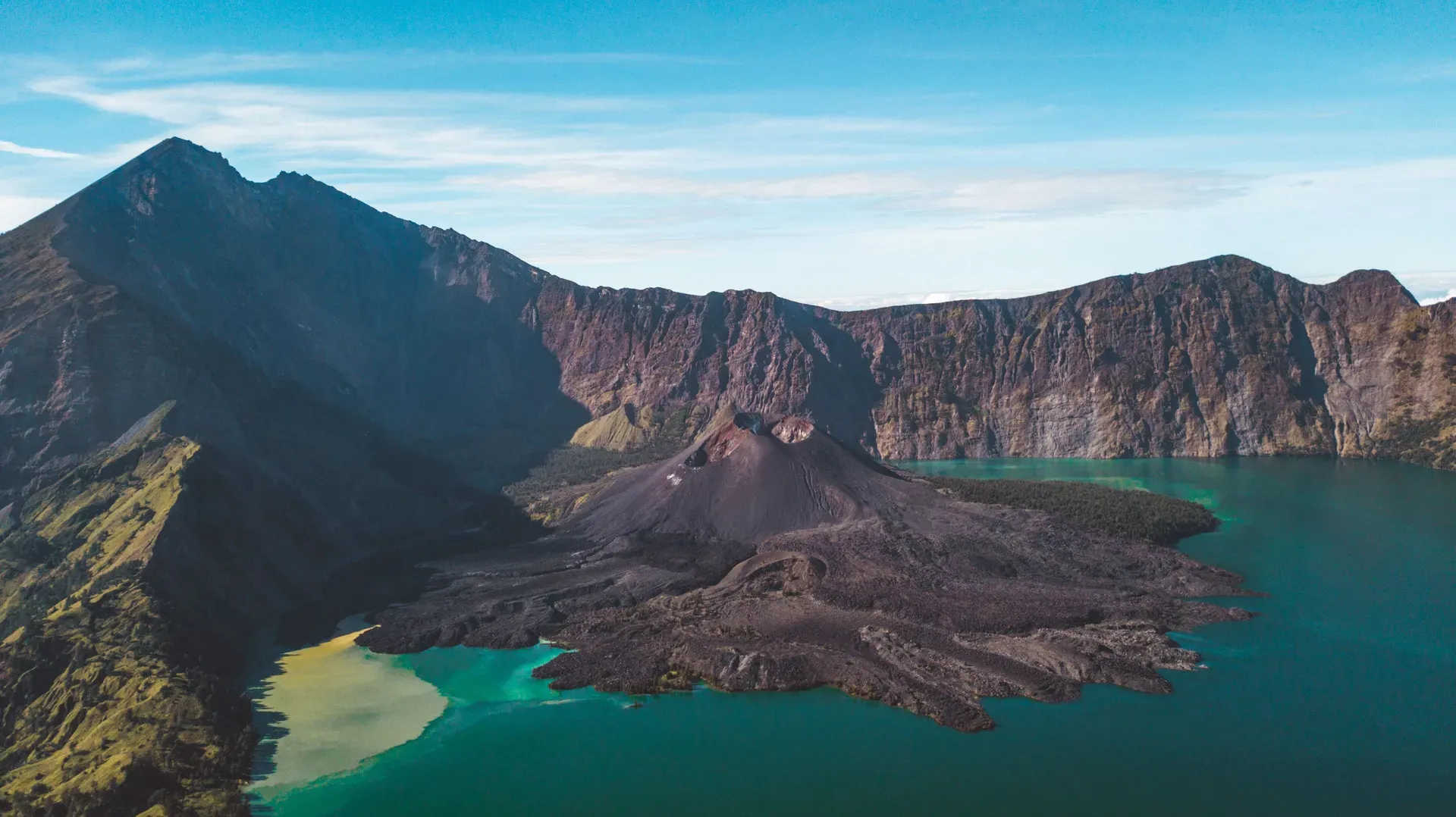
Mount Rinjani is an active 3,726-meter stratovolcano on the Indonesian island of Lombok. It contains a massive 6-by-8.5-kilometer caldera holding the turquoise Segara Anak crater lake.
Mount Rinjani is an active stratovolcano dominating the northern half of Lombok in West Nusa Tenggara, Indonesia. It reaches 3,726 meters above sea level. This makes it the second-highest volcano in the country. The peak sits inside the 41,330-hectare Gunung Rinjani National Park, surrounded by another 66,000 hectares of protected forest.
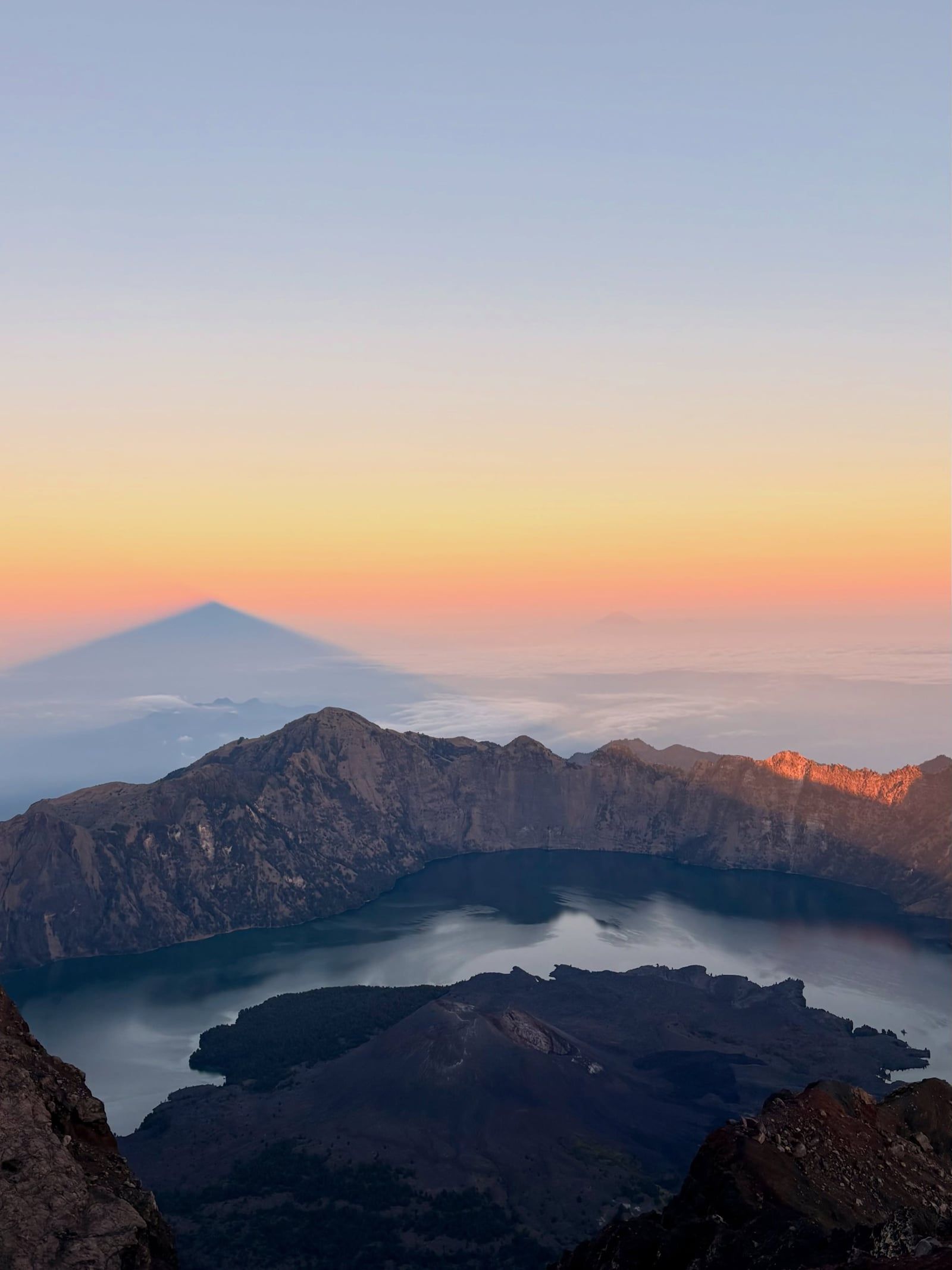
The mountain's defining feature is a massive 6-by-8.5-kilometer caldera. Inside this basin lies Segara Anak, a turquoise crater lake resting at 2,000 meters elevation. An active post-caldera cone named Mount Barujari rises directly from the water's edge.
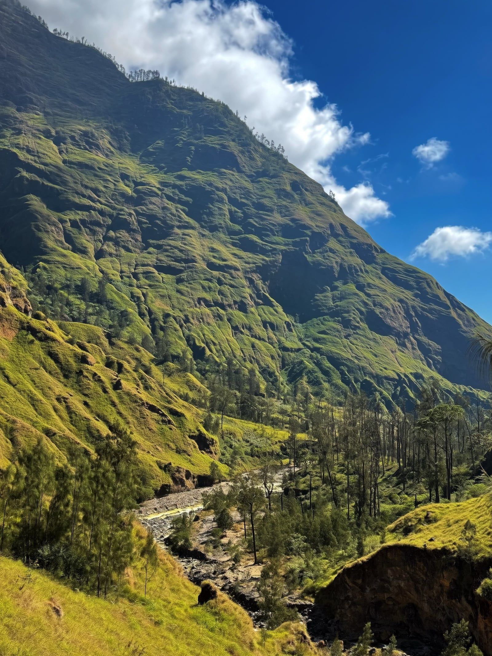
Trekkers approach the summit through two primary environments. The northern Senaru route climbs through dense montane rainforest populated by long-tailed macaques. The eastern Sembalun route crosses open savanna grasslands dotted with wild edelweiss. Both paths converge at the crater rim. From the Sembalun rim camp, climbers face a steep, pre-dawn push up loose volcanic sand starting at 2:00 AM to reach the summit by sunrise. The view from the top stretches all the way to Mount Agung in Bali.
The climb demands serious physical fitness. Hikers routinely walk six to ten hours a day. Nighttime temperatures at the crater rim drop close to freezing. The terrain is steep, exposed, and occasionally dangerous. In June 2025, a 26-year-old Brazilian tourist died after falling 300 to 500 meters from a ridge trail near the crater. You'll need to stick strictly to the marked paths.
Most visitors book a two-day trip to the crater rim or a three-day circuit down to the lake. Down at Segara Anak, natural hot springs flow over volcanic rock. Trekkers bathe in the sulfurous water to recover from the descent. The park requires all foreign visitors to hire a licensed guide and porter through the official e-Rinjani system. Daily quotas apply per route, and one guide may lead a maximum of five guests. The park opens for trekking daily from 07:00 to 19:00 WITA. Official gate check-in runs until 15:00, but operators push hikers to start by 13:00 to reach the first camp before dark. The entire mountain closes to trekkers from January 1 through March 31. Heavy monsoon rains wash out trails and increase landslide risks during these months. Most international visitors fly into Lombok International Airport and drive three hours north to the gateway villages of Senaru or Sembalun.
Mount Rinjani's current geography stems from one of the most violent volcanic events in recorded human history. In 1257, the former twin peak known as Samalas detonated in a VEI-7 eruption. The blast sent a column of ash and debris 43 kilometers into the stratosphere.
The entire Samalas mountain collapsed inward. This created the massive 6-by-8.5-kilometer caldera that now holds Segara Anak lake. Scientists link the ash and sulfur dioxide released during this eruption to global climate anomalies, including the onset of the Little Ice Age. Ice cores from Greenland and Antarctica contain chemical signatures matching the 1257 event. Before this eruption, the Samalas peak likely stood even taller than Rinjani's current 3,726-meter summit.
Volcanic activity didn't stop after the collapse. A new cone, Mount Barujari, eventually formed inside the caldera. It sits on the eastern edge of the lake and continues to erupt periodically.
Recorded eruptions from Barujari occurred in 1994, 2004, 2009, 2010, and 2015. The most recent blast happened on 27 September 2016. These eruptions frequently force the temporary closure of trekking routes and shower the surrounding villages with ash. The 2016 eruption sent a plume of ash two kilometers into the sky, forcing the evacuation of hundreds of trekkers from the caldera.
The Indonesian government officially established Gunung Rinjani National Park in 1997. The initial protected area covered 41,330 hectares. Authorities later added a 66,000-hectare buffer zone of protected forest to prevent illegal logging and manage agricultural expansion.
In April 2018, UNESCO designated the Rinjani Caldera as part of the Global Geoparks Network. The designation recognized the site's geological significance and ecological diversity.
Management of the mountain has grown stricter over time. The park administration introduced the e-Rinjani online permit system to control daily visitor numbers. Foreign tourists must now hike with licensed guides and porters. The 2026 fee update under Minister of Forestry Regulation No. 17/2025 introduced specific pricing tiers. The Sembalun, Senaru, and Torean routes fall under Class 1 and 2, costing foreign tourists up to IDR 250,000 per day. Lesser-used routes like Timbanuh, Aik Berik, and Tete Batu cost slightly less at IDR 150,000 to 200,000 per day. The government also mandated a separate trekking insurance policy of IDR 290,000 per person, covering up to four days on the mountain. The park enforces a strict pack-in, pack-out waste policy. Rangers actively check bags at the gates, confiscating prohibited items like single-use plastics, wet wipes, and portable speakers. Violators face confiscation of their gear and placement on a public blacklist.
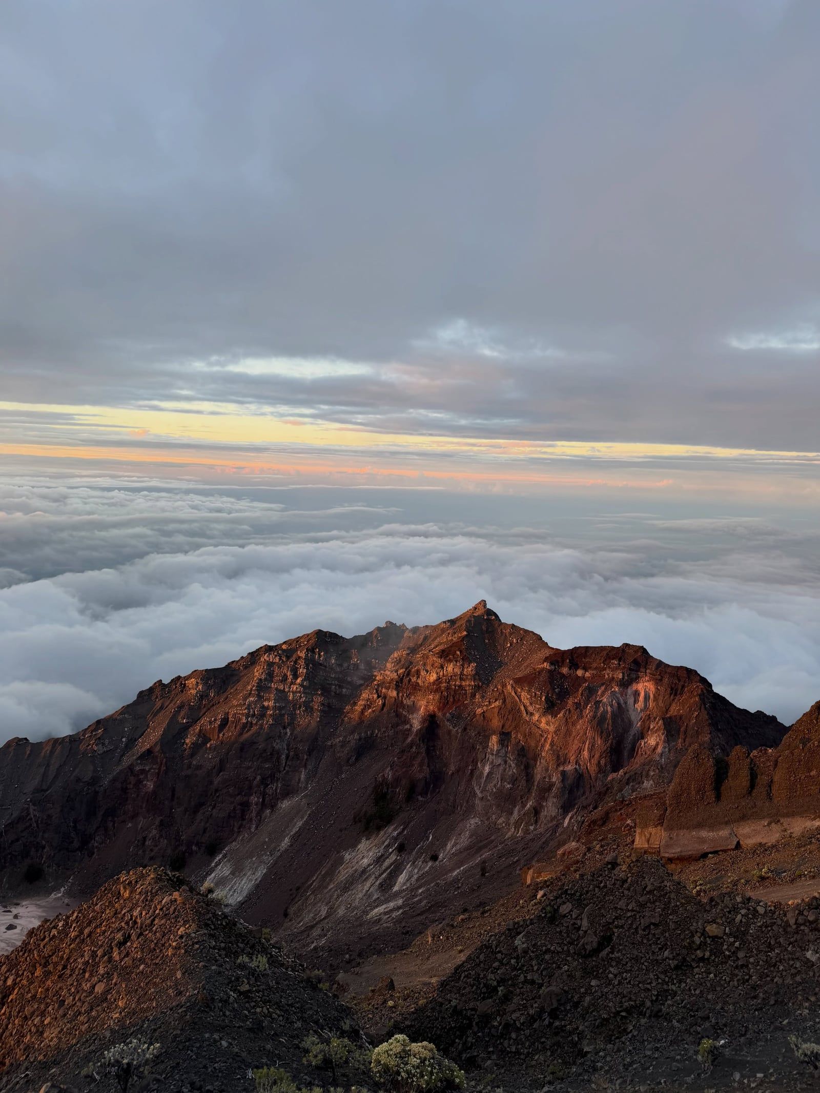
Mount Rinjani is a somma-type stratovolcano located on the Sunda Arc. This section of the Pacific Ring of Fire formed where the oceanic crust subducts beneath the Australian continental shelf. The mountain's base spans roughly 50 kilometers across northern Lombok.
The 6-by-8.5-kilometer caldera dominates the upper elevations. Steep rock walls drop hundreds of meters from the crater rim down to the basin floor. Segara Anak lake fills the western half of this depression. The water sits at roughly 2,000 meters above sea level and reaches an estimated depth of 200 meters. The lake's striking turquoise color comes from dissolved sulfur and other volcanic minerals.
Mount Barujari occupies the eastern side of the caldera. This active cinder cone rises directly from the water. Its slopes consist of dark, loose volcanic scree and hardened lava flows from recent eruptions. Near the base of Barujari, geothermal activity heats groundwater to create the Aik Kalak hot springs. The water flows over volcanic rock into natural pools where trekkers swim.
The national park sits within the Wallacea biogeographic transition zone. This invisible boundary separates Southeast Asian flora and fauna from Australasian species. The lower slopes on the northern Senaru side contain dense montane rainforests. These woods harbor long-tailed macaques, ebony leaf monkeys, and endemic bird species. Waterfalls like Tiu Kelep cut through the jungle near the trailheads. Here, water drops 45 meters down a sheer, fern-covered cliff into a shallow pool.
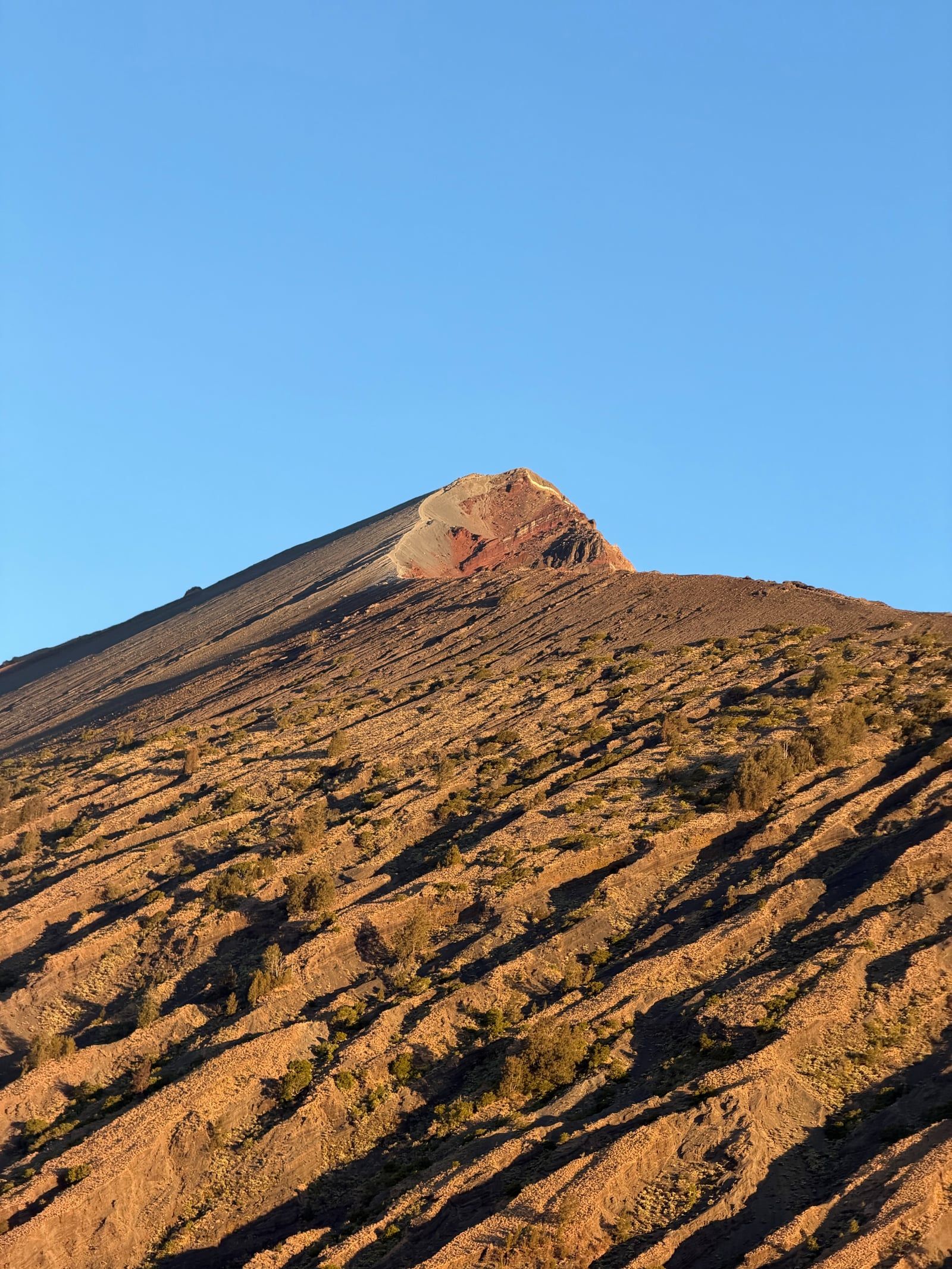
The eastern Sembalun approach looks entirely different. The rainforest gives way to rolling savanna grasslands. During the dry season, these hills turn golden brown. Wild edelweiss grows in the higher, cooler elevations near the crater rim. Outside the immediate caldera, Bukit Pergasingan rises above the agricultural valleys where locals farm onions and garlic. Hikers climb this hill for sunrise panoramas over the Sembalun Valley. The final push to the 3,726-meter summit involves climbing a steep, exposed ridge composed almost entirely of loose volcanic sand and gravel. Hikers slide backward half a step for every step forward.
Mount Rinjani holds deep spiritual meaning for both the indigenous Sasak people of Lombok and Balinese Hindus. The mountain is considered a sacred space where the physical and spiritual worlds intersect. The mountain's name itself likely derives from an old Javanese word meaning "God" or "Creator."
For the Sasak, the volcano is the domain of Anjani, a powerful goddess or queen of the spirits. Local residents regularly undertake pilgrimages up the steep trails to the caldera. They conduct ceremonies at Segara Anak lake and leave offerings of rice, fruit, and coins in the water or near the hot springs. These rituals ask for rain, good harvests, and protection from illness. Sasak guides and porters often pause at specific shrines along the trail to light incense and pray for safe passage.
Balinese Hindus view Rinjani as one of the sacred mountains of the archipelago, alongside Mount Agung in Bali and Mount Bromo in Java. They perform the Pekelem ceremony at the lake. During this ritual, pilgrims release small gold or silver items into the water to honor the gods and maintain cosmic balance.
The hot springs near the lake, known locally as Aik Kalak, are believed to possess healing properties. Pilgrims and trekkers alike bathe in the sulfurous water to cure skin conditions and relieve muscle pain. During major religious holidays, hundreds of local pilgrims camp along the shores of Segara Anak. They fish in the lake, which the government periodically stocks with tilapia and carp. Trekkers frequently share the lakeside campsites with these pilgrims. The mountain's religious status means visitors are expected to behave respectfully. Loud noises and swearing are considered offensive to the spirits residing in the caldera.
The 1257 Samalas eruption was so massive its ash reached the stratosphere and altered the global climate.
Segara Anak translates to "Child of the Sea," named for its blue water resembling the ocean.
The park sits in the Wallacea zone, mixing Asian and Australasian wildlife.
Natural hot springs near the lake reach temperatures comfortable for bathing at 2,000 meters elevation.
Single-use plastics and portable speakers are strictly banned and confiscated at the park gates.
Wild edelweiss flowers grow on the upper slopes and are illegal to pick.
The entire national park closes to trekkers from January through March due to heavy monsoon rains.
Foreign trekkers pay IDR 200,000 to 250,000 per day for park entry on the main routes. You must also buy mandatory trekking insurance for IDR 290,000. Total package costs with a required guide and porter run several hundred US dollars.
Yes. National park regulations require all foreign trekkers to hire a licensed guide and porter. You must book this through an officially registered trekking organizer via the e-Rinjani system.
Most hikers choose a two-day, one-night trip to the crater rim. A three-day, two-night itinerary allows time to reach the summit and descend to the crater lake. Longer routes across the mountain take four to five days.
The national park officially closes to all trekking from January 1 to March 31 every year. Heavy rains during this period cause trail washouts and increase the risk of landslides.
May to October offers the best dry-season conditions. July and August bring the clearest skies but the heaviest crowds. May, September, and October provide a good balance of stable weather and fewer hikers.
The trek carries genuine risks. The trails feature steep, narrow ridges and loose volcanic sand. In June 2025, a tourist died after falling from a ridge path, proving the danger of straying from marked routes.
Segara Anak is a large crater lake located inside Mount Rinjani's caldera at 2,000 meters elevation. It formed after the 1257 eruption of the Samalas peak and reaches depths of around 200 meters.
Fit beginners can complete the trek if they train beforehand. The daily distances are long and the elevation gain is severe. Guides recommend the shorter crater-rim route for those with less hiking experience.
You can fly 30 minutes from Bali to Lombok International Airport, then drive three hours to the trailheads at Senaru or Sembalun. Alternatively, you can take a fast boat to the Gili Islands and transfer through Bangsal Harbour.
Bring sturdy hiking boots, a waterproof jacket, and a headlamp for the night summit push. You'll need warm layers, gloves, and a beanie, as crater rim temperatures drop near freezing at night. Pack reusable water bottles to comply with the park's plastic ban.
Browse verified tours with free cancellation and instant confirmation.
Find Tours